Sheridan's Backyard · Big Horn Mountains
Red Grade Road:
The Other Side of the Mountain
2026–2027 Construction Notice: Red Grade Road closes Monday–Friday, 8 am–6 pm, May through October both years. Weekends and early mornings remain open. Details below.
There are two ways into the Bighorns from Sheridan's side of the valley. Highway 14 heads north to Dayton before climbing into the mountains — paved, well-traveled, the route most visitors find first. Red Grade Road heads west out of town on gravel and doesn't apologize for itself. Steep where the terrain demands it. Quiet in the way that mountain roads get quiet when they filter out everyone who isn't paying attention.
A Road Before There Was
Much of a Sheridan
Red Grade Road is older than most people assume. Rancher Montague Moncreiffe used this route to move horses over the mountains — contracted to supply the British Army during the Boer Wars, a detail that lands differently when you're grinding up the grade in a truck, imagining it on horseback. The road existed because it was the most direct line through the terrain. It still is.
The Moncreiffe name appears on the trail map today as an overlook on the upper west half of the system — a quiet acknowledgment that this ground has been in use for a long time, and that the people who knew it best were the ones who traveled it regularly.
The Cloud Peak Scenic Byway — the route most out-of-town visitors know by name — runs out of Buffalo, an hour south. It's a beautiful drive and it earns the designation. But it's not a Sheridan road. Red Grade is. And for the people who live here and use these mountains regularly, that distinction matters.
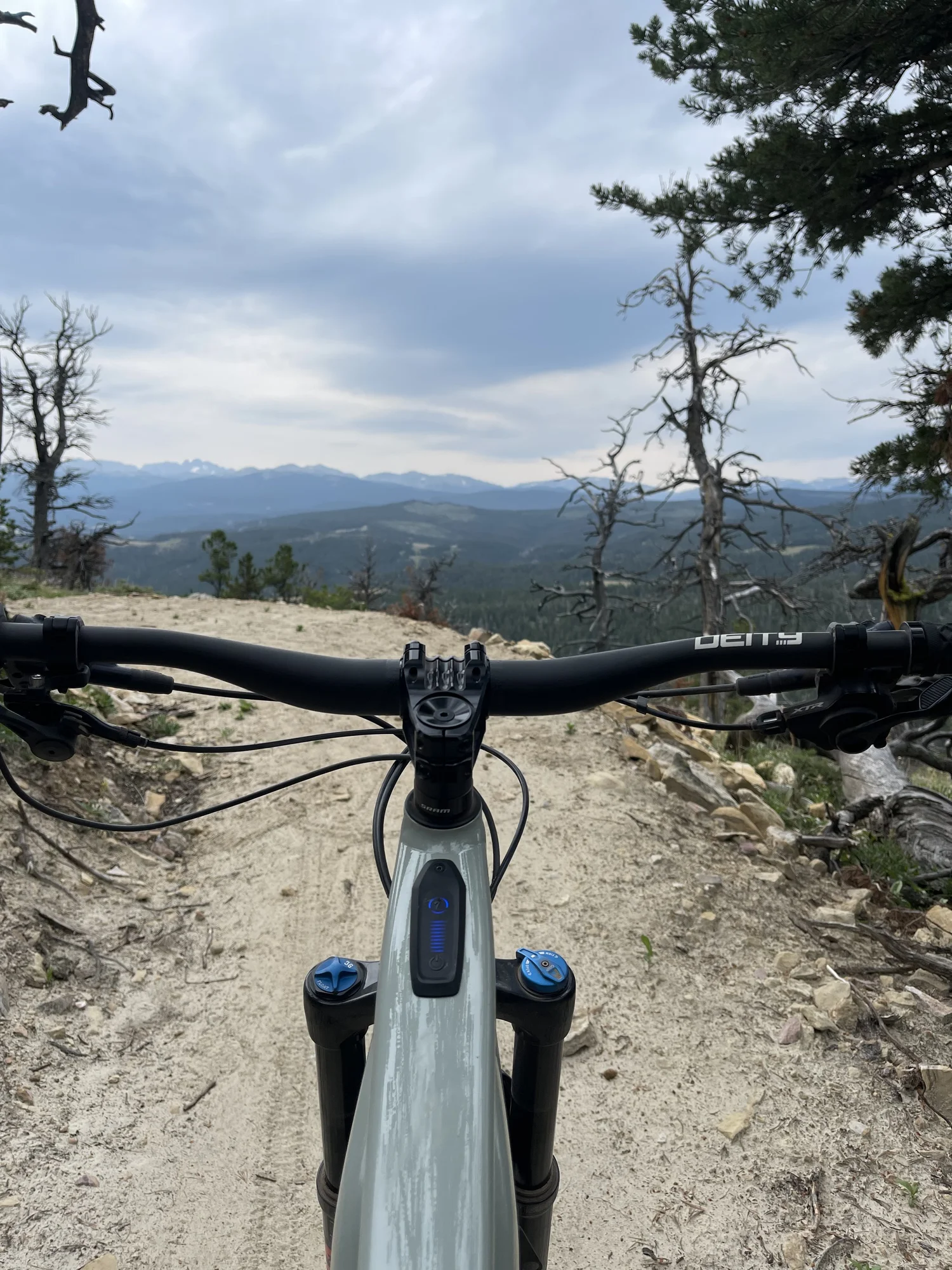
Upper Red Grade Trails near Bear Gulch — Cloud Peak and Blacktooth Peak in the distance
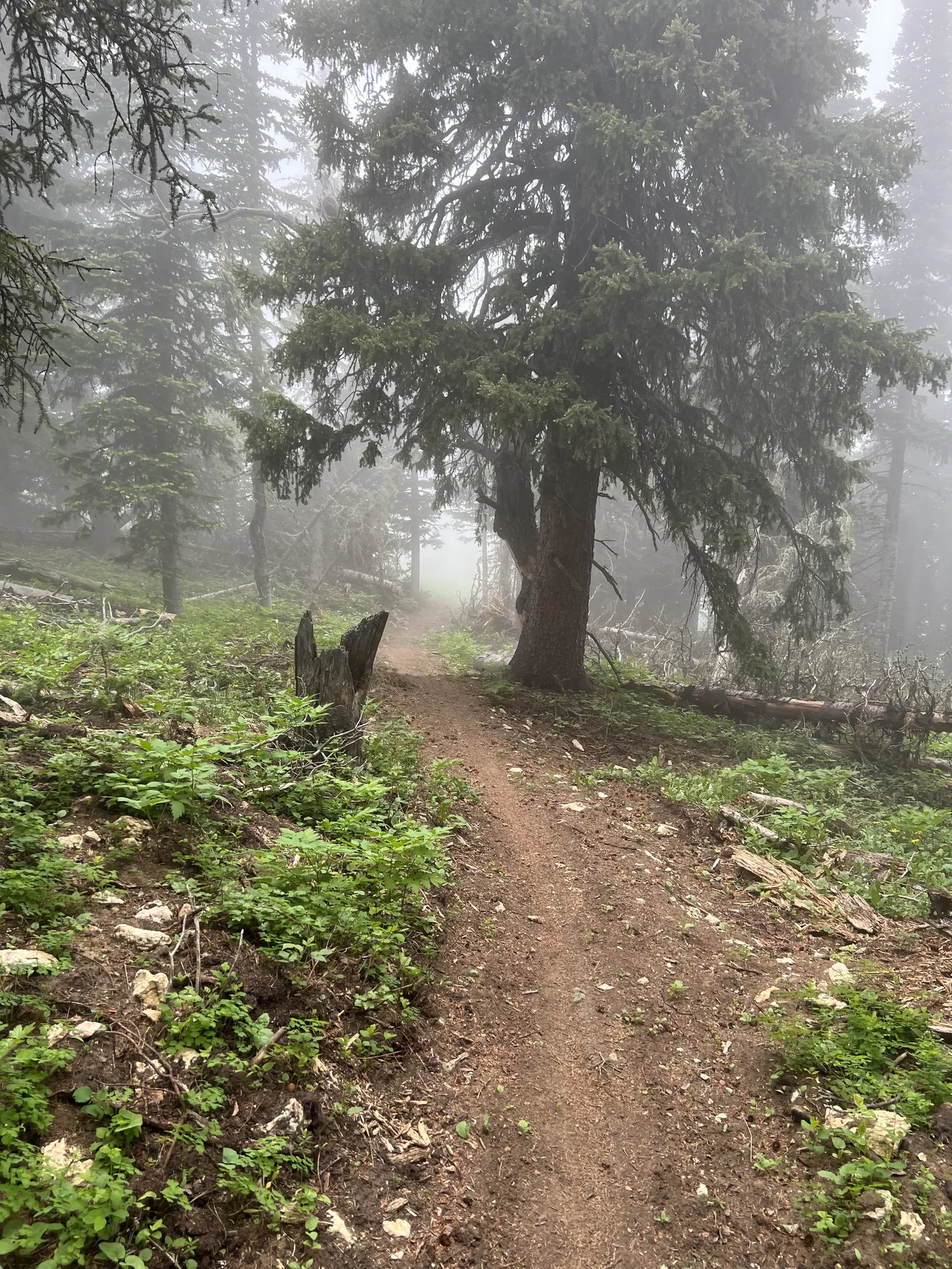
A misty morning on the upper trail system
What They Built
Up There
The Sheridan Community Land Trust has been quietly developing one of the better trail systems in the region along the Red Grade corridor, and most people in Sheridan still haven't found it. The full system spans two halves of the mountain — east and west — connecting five trailheads: Base, Springs, The Aspens, Poverty Flat, and the Bear Gulch trailheads on the west side.
The trail map reads like a legitimate mountain bike destination. The Brink runs 2.7 miles across the west half and connects via Bear Gulch on the upper end — fast, exposed, with views that open over the canyon. Bear Knuckle covers 2.75 miles with access from Poverty Flat. Fire Up climbs 1.9 miles from The Aspens Trailhead and feeds into the upper network. Shorter connectors — Fahrenheit, Little Bear, Updraft, Growler, Drifter — give riders and hikers the ability to string together a full day or cut it short depending on legs and weather.
All trails are rated intermediate. Biking, hiking, and equestrian use are permitted on select trails, with hiking-only and biking-only sections mapped clearly. The system sits on public land managed by the State of Wyoming, BLM, and USFS.
- The Brink 2.7 mi · West half · Fast, exposed, views over the canyon Recommended
- Bear Knuckle 2.75 mi · Poverty Flat access · Biking, Hiking, Equestrian Recommended
- Fire Up 1.9 mi · From Aspens Trailhead · Feeds upper network Recommended
- Let 'em Roll 1.2 mi · Lower system · Sandy and slick in dry conditions Use Caution
- Fahrenheit 0.75 mi · Lower connector
- Little Bear 0.7 mi · Counterclockwise · Multiple loop options
The Sheridan Community Land Trust maintains the Red Grade system and a number of other trails throughout the area. Current conditions, downloadable maps, and updates on new trail additions are posted at SheridanCLT.org/recreation/maps — worth checking before any trip, and worth bookmarking if you're spending time in Sheridan.
What You Need to Know
Before Summer 2026
Here is the information that isn't posted clearly anywhere visitors are likely to find it.
Red Grade Road Construction Closure
May – October 2027
The Federal Highway Administration is widening approximately 2.5 miles of Red Grade Road from the Base Trailhead southeast — adding pullouts, improving drainage, and raising the Aspens Trailhead parking lot grade. Parking lots at Base, Springs, and Aspens trailheads will be used for construction staging during weekday hours. Trails on USFS land and those accessible via trailheads outside the project area remain open throughout construction. Full details: sheridancountywy.gov
For anyone planning a summer trip to Sheridan and expecting to hike or ride Red Grade on a Tuesday afternoon, this matters. Plan for early mornings, evenings, or save it for the weekend. The road and the trails are worth the scheduling.
From Someone Who Knows
Every Inch of It
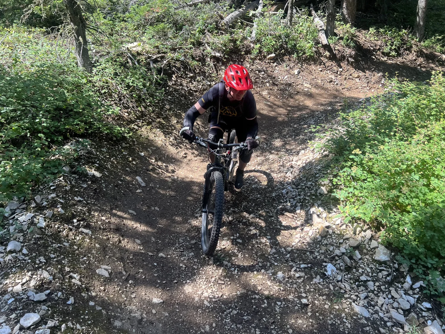
Darin on Let 'em Roll · Red Grade Trails
Darin has ridden the Red Grade trail system in every season — including January on fat tires, which is either inspiring or alarming depending on your relationship with Wyoming winters.
His read on the system is useful because it comes from actual accumulated miles, not a trail app.
The Brink is probably my favorite section. Very fast, smooth, and technical. You can do a short ride or turn it into an epic loop — they've added enough up there that 20 to 25 miles is achievable without going around in circles.
— DarinThe flexibility is the first thing worth understanding. The trail network has grown enough that a rider can put together a legitimate 20 to 25-mile day without repeating terrain — or keep it short with a loop at the bottom or top of the system. Both options exist without compromise.
Let 'em Roll has gone sandy and slick. Still rideable, but worth knowing going in. The descent from The Aspens Trailhead into the lower network is the run most people haven't found yet — really fast, very technical, the kind of descent that makes the drive up the grade feel like a reasonable trade. Worth confirming the exact segment name on the current SCLT map before you go, as the system continues to evolve.
And then there's the shuttle option: start at Bear Gulch on the upper west side and ride down. All the elevation gain, none of the climbing.
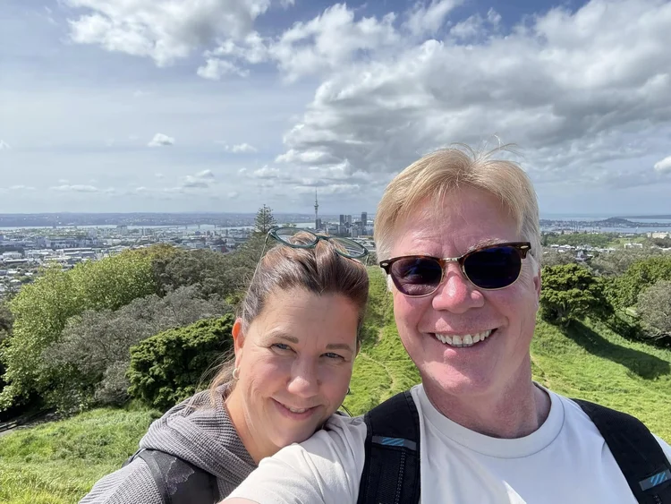
Darin & Marisa · On The Rocks Jewelry · Sheridan, Wyoming
Darin & Marisa
Darin and Marisa have been part of Sheridan's fabric long enough to have watched the town change and stayed anyway. They arrived with an idea for a shop, opened 45th Parallel on Main Street — an eclectic, well-curated stop that became a fixture — built it into something the town came to count on, and sold it in 2008. Two years later they opened On The Rocks Jewelry, also on Main Street in Sheridan, Wyoming. Marisa runs the floor with a small team. Darin handles the design, the repair work, and the marketing. Both businesses are still open today — 45th under different ownership, On The Rocks very much alive.
The trails are Darin's thing. He rides Red Grade year-round, every season, in conditions most people wouldn't consider. When he offers a trail note, it isn't a recommendation from someone who did a quick search — it's a report from someone who was just there.

Sheridan Bicycle Company
If you're riding Red Grade and need anything before you go — a tube, a last-minute adjustment, local beta on trail conditions — Sheridan Bicycle Company on Main Street is the stop. Open since 2013, it's the kind of bike shop that actually knows the terrain outside town. Darin shops there. That's about as good a reference as you'll find in Sheridan.
A note worth flagging: if you're searching for bicycle rentals in Sheridan, Wyoming, Sheridan Bicycle Company is not a rental operation. Shop work is first come, first served. What they offer is better than rentals — they're a genuine local resource staffed by people who ride the same trails you're about to. Stop in before you head up the grade.
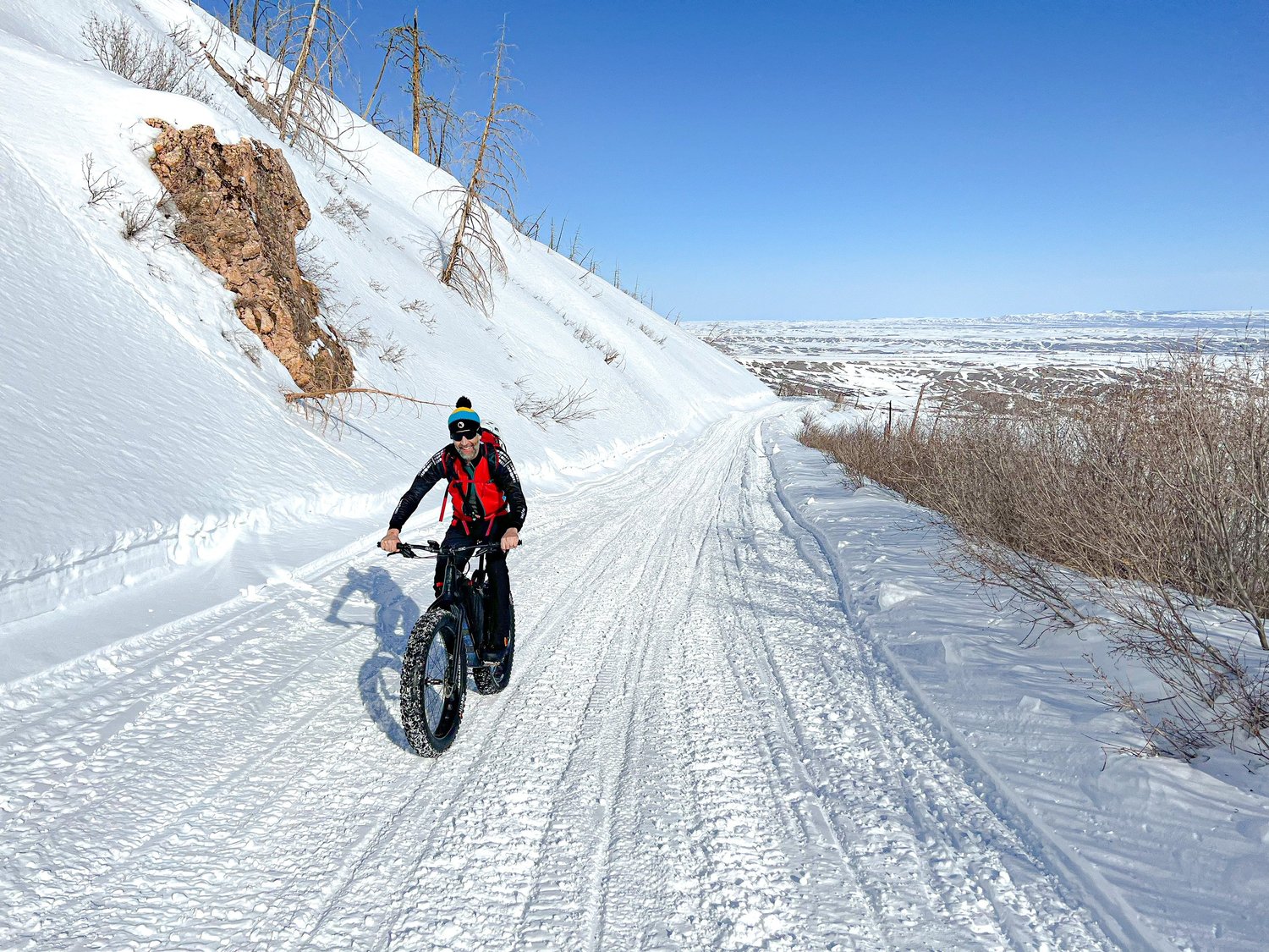
Fat tire season · Red Grade Road · January
The Upper Trails
in Season
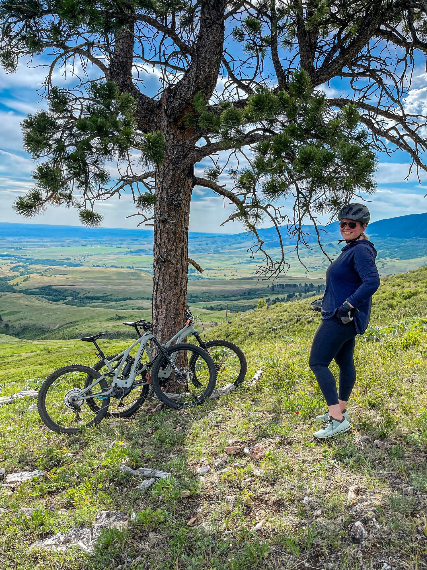
Kayla on the lower trails · Early spring
Tyler and Kayla run Late Checkout WY and know the Sheridan backcountry the way you do when you actually live somewhere. They ride the upper portion of the Red Grade trail system on mountain bikes and hike the trails when conditions open up.
The experience up there is different from what you find lower on the mountain. Quieter. More exposed. With views that feel earned rather than stumbled into — the Moncreiffe Overlook, the Tepee Overlook, the Big Goose Overlook. These aren't pull-off-and-photograph stops. They're destinations you reach after putting in the work.
The upper trails open later in the season and close earlier. Snow lingers. When the window is there, it's worth using.
The overlooks up top are the kind of views that make you forget you were ever tired getting there.
— Tyler, Late Checkout WY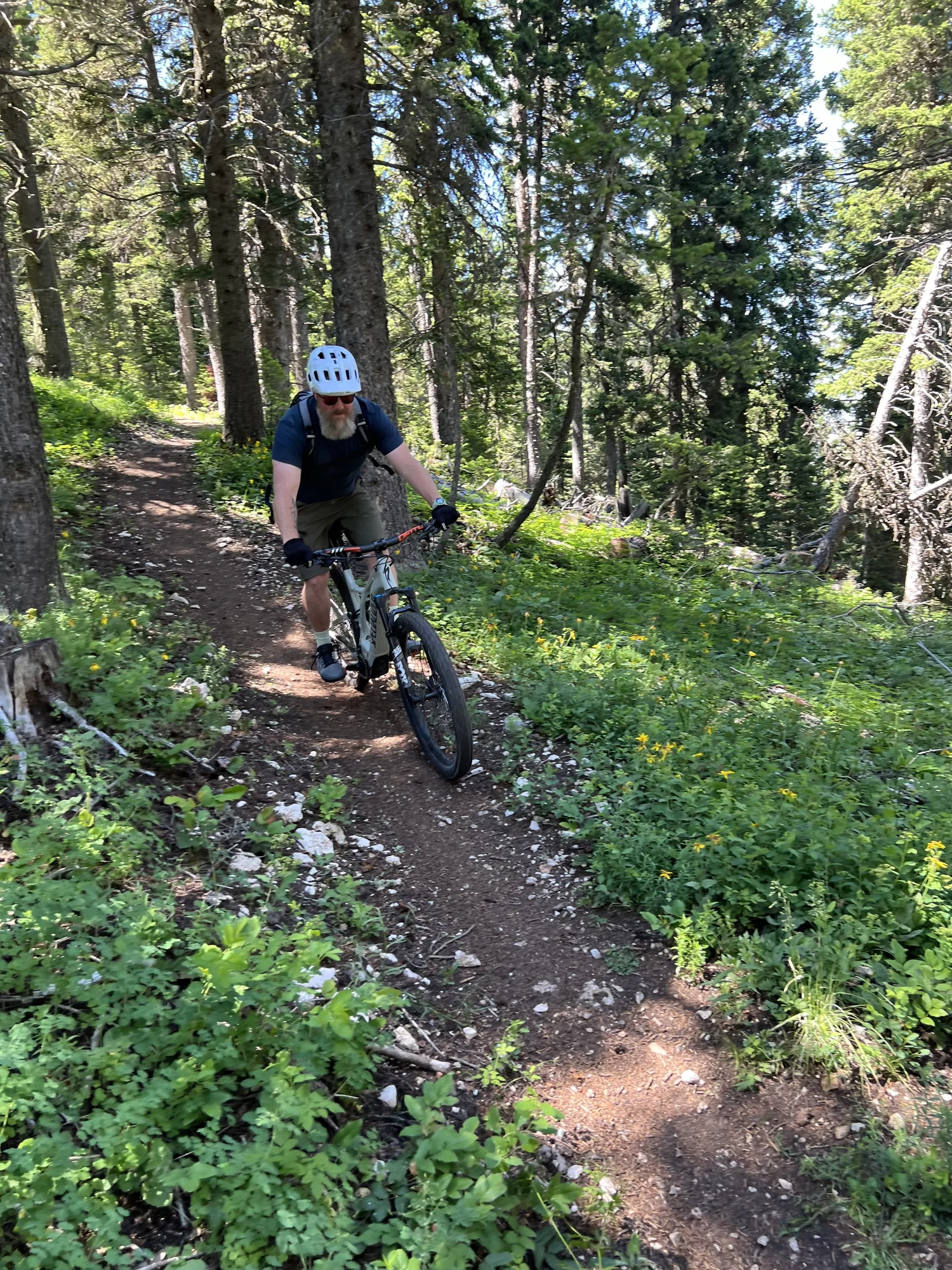
Tyler on the upper portion · Red Grade Trails
The Access Point
Most Visitors Miss
Red Grade Road continues past the trail system into Bighorn National Forest. For Sheridan-side visitors, it is the quiet alternative to driving south to Buffalo and picking up the byway — a longer route that adds significant time and mileage for anyone staying in town.
The byway is well-signed and well-traveled for a reason. But if you're based in Sheridan and the backcountry is what you're after, Red Grade puts you on the mountain faster and with considerably less company.
Most visitors never find it. They follow the signs to the highway routes and miss the gravel road heading west entirely. That's partly what makes it worth knowing about before you arrive.
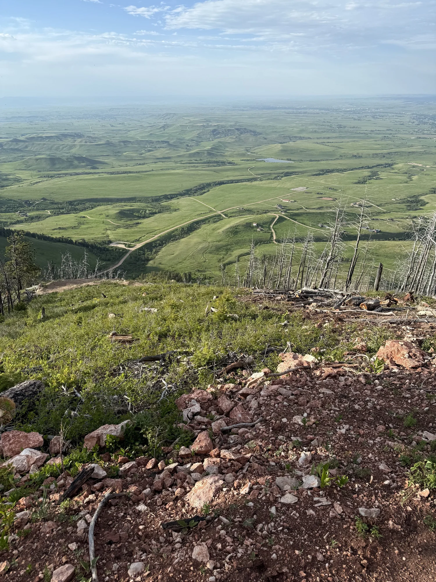
Looking east toward the valley floor · Spring
Red Grade Road closures are in effect Monday through Friday, 8 am to 6 pm, during construction seasons May–October 2026 and May–October 2027. Weekends, holidays, and early mornings and evenings remain open. Trail access information courtesy of the Sheridan Community Land Trust — full system maps and current conditions at sheridanclt.org/recreation/maps. Construction details via Sheridan County: sheridancountywy.gov.